back home…

After 13400 nautical miles, Ojalá has found her way home.

It seems she really felt like it, because during the last days, she tacked like a racing boat on the North Sea, and with the wind blowing from behind on the Ijsselmeer, we had to decrease sail to make sure we didn’t arrive at the harbour too early.

There might be people who think that the last week of our trip could have been boring, because we were already so close to home, but this is everything but true. A few more words on this will follow at the end of this blog, only for those who do not mind reading “smell sensitive” issues.

How to sum up the last week:

  • feeling welcome in the Netherlands and celebrating with dear friends. After the welcome Maarten’s parents had already given us in Vlissingen, we had barely moored in Scheveningen when we heard someone shout “Ojalá” on shore: our dear friends from White Witch and Marleen were standing there and waiting for us! A lovely afternoon with coffee, wine and dinner followed!
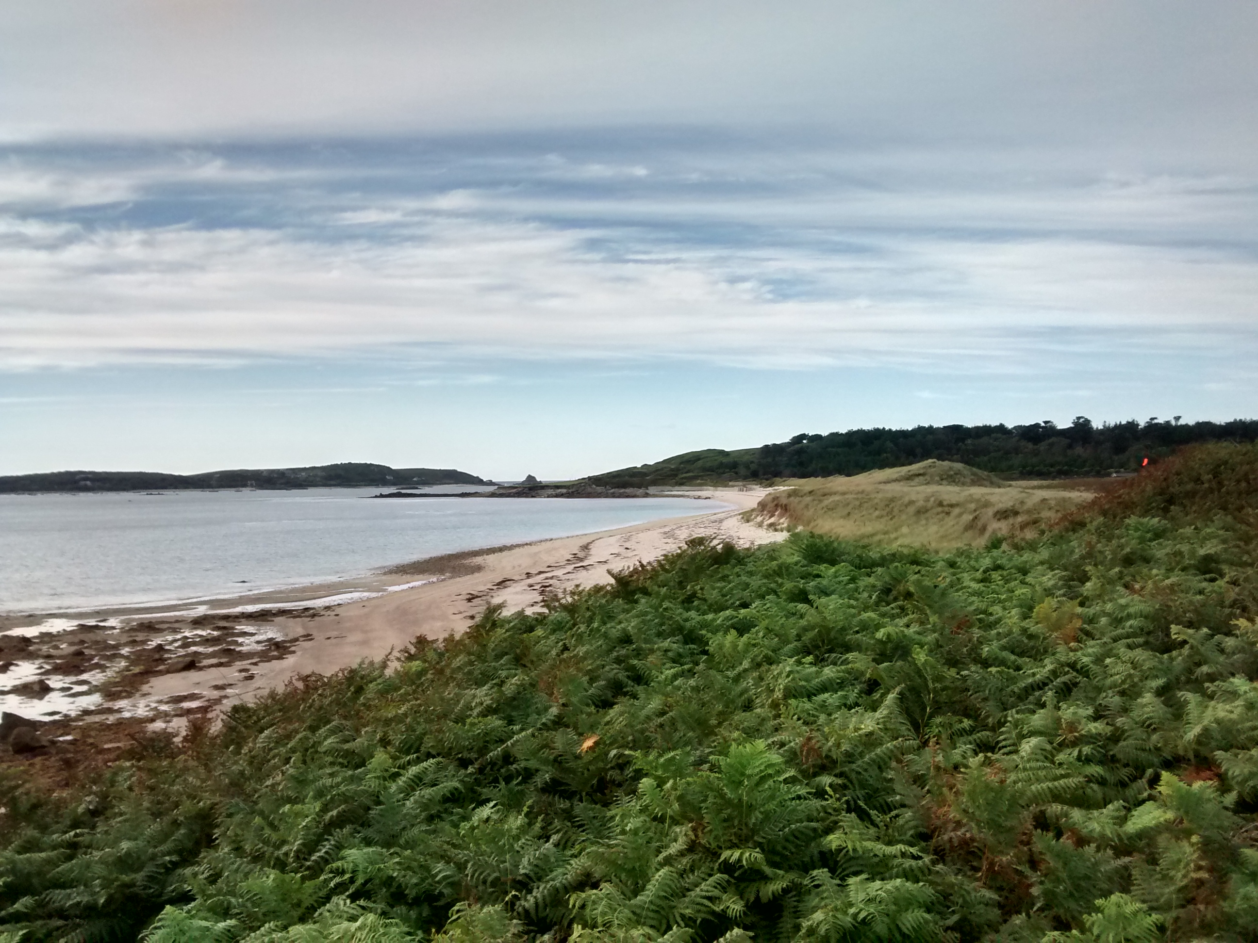
  • Sailing home against the wind: since we left Stellendam, the wind had decided to stay on the nose: we had to tack to Scheveningen, then to Ijmuiden, then to Muiderzand, and then to Lelystad where we arrived just before nightfall to spend our last night “on the road”. At last, during our last trip to Enkhuizen, Ojalá enjoyed a relaxed ride with the wind from behind.
the last evening on the road - the Ijsselmeer treated us with a beautiful sunset

the last evening on the road – the Ijsselmeer treated us with a beautiful sunset

blog_IMG_1816 blog_IMG_1809

And then, the big day:

On Saturday, the big day had come: just as promised, at 13:30, we arrived at the Buyshaven where a crazily shouting crowd was waiting for us. Even god Neptune had taken the effort to come down from heaven and welcome Ojalá in her home port. What a privilege!

Neptune getting ready to welcome the sailors

Neptune getting ready to welcome the sailors

The Dutch flag carrier is ready

The Dutch flag carrier is ready

The one for the German flag still has to decide whether she wants to take part in the party

the one for the German flag still has to decide whether she wants to take part in the Party

Ojalá sailing the last meters to the harbour

Ojalá sailing the last meters to the harbour

until she arrives to the welcoming committee

until she arrives to the welcoming committee

blog_DSC_3168

Neptune in action

Neptune in action

entering the box

entering the box

sailors are happy that they made it home safe and sound

sailors are happy that they made it home safe and sound

Neptune turns into a father happy to receive the son back safe and sound

Neptune turns into a father happy to receive the son back safe and sound

a certified copy of our painting in Horta - great art!

a certified copy of our painting in Horta – great art!

many courtesy flags decorate Ojala's mast

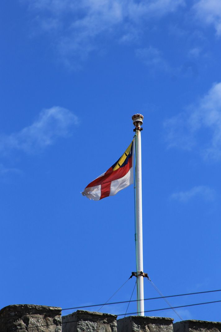
many courtesy flags decorate Ojala’s mast

closing a circle: going back to the same Pizzeria where we already celebrated Ojala's baptism

closing a circle: going back to the same Pizzeria where we already celebrated Ojala’s baptism

The welcome couldn’t have been better: from good wishes, welcome posters, champagne, great food and of course the much needed hugs from family and friends – everything was there! Clearly, our parents and friends had done the best job ever to ensure we had a great welcome. Indeed, there was not a second to be sad about the fact that our trip had ended, we were just too happy to see everyone. But, in fact, we got so many care packages (with liquid and solid ingredients) that we could just leave again now for another trip 🙂

we could just leave again - after all the care packages we got, Ojalá's storage is full of delicatessen again

we could just leave again – after all the care packages we got, Ojalá’s storage is full of delicatessen again

the last champagne of the trip!

the last champagne of the trip!


DSC_4837

delicious, home-made food!

Apart from all the celebrations, our guests also had to work hard: we had prepared a quiz on the content displayed on our blog during the past 15 months. But of course, for our loyal blog readers, there was not much difficulty to respond to the questions and soon afterwards, the winners were enjoying amazing prices, such as a tin of condensed milk (ideal to prepare dessert AND to prepare a trap for cockroaches…).

serious moments during the Party - guests on the way to their quiz Price: two ice cold beers, freshly brought from the Azores

serious moments during the Party – guests on the way to their quiz Price: two ice cold beers, freshly brought from the Azores

On Sunday, the celebrations continued and Maarten’s nieces requested a ride on Ojalá on the Ijsselmeer. Luckily, the weather gods treated us gently and while we were moving with 1.5-4 knots of speed in 1-3 beaufort of wind the two young ladies AND her parents were happy.

Since yesterday, the after-trip reality has started again: the “klus lijst” has grown longer and longer. From equipment we want to sell over normal maintenance, smaller and bigger repairs, and of course, finally, the resolution of the shroud mystery (we seem to be on a good path now!!!): a lot needs to be done to prepare Ojalá not only for the winter storage but also for the next years.

At the same time, while Ojalá has returned to her home harbour, it might still take a while until we have moved into a new home… Given that we both do not have a job at this moment, we do not want to move in somewhere “in transit” but we will continue living on our floating house for as long as we can (before she stops floating) and hope that we will only move once we know where we will end up working. Ideally, this time, we manage to do so the same country or even the same city. We do not know anything yet, but following the motto of the trip we are both convinced that “alles komt goed”!

But from now on, life will be less about adventures, white beaches, turquoise waters, turtles and sun. Slowly but surely, we will be returning to “normal life”, keeping the experience and adventures we lived through within us. To avoid any doubt, the weather during the past 48 hours has been force 6-7 in the harbour, constant rain and sometimes thunderstorms…

This means, this will be the last blog entry we write. While the Ojalaenkhuizen blog will remain online for whom ever is interested to read about our past experience, don’t be surprised if you do not read any further news from now on. We will continue sailing Ojalá but distances and time will probably decrease considerably.

As we already said to those that welcomed us in Enkhuizen:

This is the moment to thank all those that have followed our blog, who have commented or who have told us through personal conversations or emails how much they enjoyed reading about our adventure. This continued to be a big motivation for us to keep reporting throughout our trip! We hope that we allowed you to live with us, and maybe to survive a tiny bit better during a windy, grey, rainy day. THANK YOU!!!!!

Poem "De Zee" - we couldn't agree more with these words, but to summarize: sea, we will miss you!!!

Poem “De Zee” – we couldn’t agree more with these words, but to summarize: sea, we will miss you!!!

And finally, the smell sensitive details:

For anyone who is reading the blog while preparing a trip him/herself: While we were reading different books and blogs during the preparations of our trip, we only read one book where someone recommended that the exchange/renewal of all hoses linking the toilet with the outside world was an important task, in order to avoid constipation of the toilet while the crew was sailing on the ocean. For all the rest of the sailors, this either didn’t seem to be a problem or no one wanted to talk about it. Therefore, we will now change the statistics – hopefully to the benefit of those who are preparing a trip today.

On Ojalá, the pump linking the toilet waste water tank with the outside world had been living its last moments for a while, but we had hoped that it would still survive all the way to Enkuizen. All went well, until two days before arrival when Maarten suddenly came on deck while we were sailing, and said: “Anna the pomp is dead”. This meant that during the next 2 days we wouldn’t have a working toilet on board. Not a problem in harbours, the challenge would certainly come up during the day whenever we would be sailing from one place to the other. Trying to think of the location of all chandleries around the Ijsselmeer from the months when we had been preparing the trip, we remembered a big shop in Almere – a harbour just a few miles from where we were sailing. As always – it seems – during this trip, we were lucky while being unlucky and could buy not only a new pump but also new hoses during the shop which Maarten then all installed during a very long half day, exposed to what was probably the worst smell during the whole trip. I considered awarding him with a medal for the toughest toilet cleaner ever! Certainly, we will never leave on a trip again without checking/or changing all type of hoses beforehand!


Almost there and estimated time of arrival

As we write this, Ojala seems to still be sailing in the direction of Scheveningen. New reports of her whereabouts have mysteriously ceased since 08/09/2015 even though she is now less then 100 miles from her home port.

Even without updates on marinetraffic we can now confirm an ETA (estimated time of arrival) between 1pm and 2pm on Saturday the 12 of September.

For better coordination with anyone who might be interested in Ojala’s (and ours ;)) exact arrival time, the engineer in charge is trying his best to repair the position reporting by Saturday morning just in time for the approach of the finishing line.

Why coastal and interior waters sailing is more stressful than ocean sailing

Before this trip I would have never used this title. When someone asks me, “what do you prefer: ocean sailing or coastal sailing”, I would probably still always say “coastal sailing, of course”. However, if I ever need to convince myself to cross an ocean again, I will simply read the following lines and I will be ready for it 😉

From Oostende we sailed to Vlissingen under a sky which could have won the competition of “the darkest shade of grey”. The Northwesterly wind had created an uncomfortable swell rolling onto the Belgian/Dutch shore which runs in a Northeasterly direction. Long gone the long ocean swell, these were short, high and ugly looking green waves, meeting Ojalá just on the beam and making us and her roll even more. But well, at least we had the current with us most of the time, and we managed to sail the 34 miles from Oostende to Vlissingen in less than 5 hours – when we entered the Westerschelde, we were surfing down the waves with more than 10 knots!

Standard weather for the past week

Standard weather for the past week

The Westerschelde is also a principle cargo shipping route as it leads to the big port of Antwerp. If you want to cross the Westerschelde from South (direction where Oostende lies) to North (Vlissingen), you need to cross this shipping route. It reminded me a bit of the day when we crossed an entire spinnaker fleet in the Spanish Rias, but this time, a crash would have certainly been less advantageous for us. Nonetheless, all went well, and we soon made it to the Michiel de Ruyter Haven in Vlissingen. At least, according to our plotter, we were there, just in front of it…

In reality, our eyes saw something different: we saw the hint of of two wooden jetties which had more or less disappeared due to high water in combination with pretty strong western wind and swell running over them. Full speed on the engine, Maarten motored towards the harbour entry to minimize drift in about 3-4 knots of cross-setting current. Suddenly, however, he saw that the little bridge which gives entry to the marina itself was showing red lights and just about managed to turn Ojalá so that we were leaving the harbour entry again. Following a short phone call to the harbour they told us: “just come in, we will open the bridge for you”. So we did. While we were on our way in, just about happy that we survived the side setting current, a pilot boat passed us with about 25 knots – their base is just next to the marina entrance… No time for heart failure, we had to move on, because we hadn’t made it into the marina, yet.

a Pilot boat leaving the marina entrance

a Pilot boat leaving the marina entrance

another one coming back in just when Win2Win is in front of the Harbour - we had the same ting

another one coming back in just when Win2Win is in front of the Harbour – we had the same ting

Normally, we always prepare fenders and mooring lines well before the harbour. This time, this wasn’t possible due to the swell. Just before the bridge, Maarten told me: “go now, we have to prepare the fenders, there is not much space inside”. Luckily, this kept me busy for the next minutes and I didn’t see how we passed the little bridge into the marina. The bridge has been built over an old lock which gave access to a fishing harbour in the past and was only about 6 meters wide. The swell still coming in from outside made it impossible for Maarten to steer straight. It was a bit like having started to slide on a snowy road and then trying to adjust steering to get the car straight again. At some moment, I was adjusting a fender on the rail, and I suddenly saw this concrete wall about 20 cm from the boat… But again, all went well, and we made it into the marina.

the

the “wide” marina entrance

For those who think that stress was over once we entered the inshore waters in Zeeland, you are wrong – there is more to follow! But before, let’s focus on the positive things.

The Michiel de Ruyter marina is a lovely place where we spent a good time sheltered from strong winds. It got even better when Jan and Elly arrived. They had decided to drive the way down into the Netherlands’ most southern corner and to welcome us on Dutch soil. We spent a lovely Friday evening and Saturday catching up, despite the weather which was trying to make life difficult for us.

After our visitors left again on Saturday afternoon, it was too late to make it anywhere far anyway, so we decided to stay another night and joined the crowd waiting for Win2Win to arrive home after 18 months away. In just one week, it will be us…

However, in order to keep up with the deadline we had set for ourselves, we had to move on at some point, good weather, or not. Saturday morning didn’t look too bad. At least it was dry, although quite cold and grey. Maarten had spent a good time reading about the best time to enter the channels of Zeeland such as to decrease waiting time in front of bridges. There seemed to be what is called a “blue wave” starting at 9:28am where we would manage to pass at least the fives bridges over the so-called “Walcheren Kanaal” within 1 hour. Win2Win was on their way to the home harbour, and next to each other, the two boats were motoring over the channel while the crews were enjoying a warm morning coffee.

motoring along the Walcheren Kanaal

motoring along the Walcheren Kanaal

with a warm Cup of coffee

with a warm Cup of coffee

However, when we got to the first bridge, we realized that even in well-organized Netherlands, not everything is organized… the bridge keeper told Maarten: “just go through when the bridge is open, don’t wait for the green light, go fast, because the channel will be blocked for all passage after you”. While we were still wondering about the reasons for this, we saw that at the shores of the channel, people were preparing a competition for some channel swimming event. This competition seemed to be important enough to block the channel; however, not important enough to inform people about it 🙂

Having sneaked our way through, we reached the town of Middleburg, where another two bridges had to be passed. We had already listened into VHF conversations about a rowing contest from Rotterdam to London of the Dutch marines, which – due to the weather – was no longer going along the Dutch North Sea coasts but would come along the Zeeland channels. In Middleburg, we realized what this meant for all other vessels on the channels: the bridges showed “double red” light and after questioning the bridge keeper, he told us that we couldn’t move until the marines had passed…

waiting for the bridges

waiting for the bridges

and the marines

and the marines

blog_IMG_1805

After this episode, bridge opening times seemed to have returned to normal and we continued our passage. Not a passage where you would sit down, switch on the auto pilot and read a book, though. We crossed the Veerse Meer, the Oosterschelde, the Krammer, and the Volkerak, to make it to the town of Willemstad in Hollands Diep. Passing through all these inshore waters meant that we wouldn’t go in a straight line from SW to NO (which is what we would have done along the North Sea route): the passage lead us into all directions, and we were constantly adjusting course, sails, checking charts, and especially making sure that we weren’t colliding with either dinghies, “falken”, other sailing boats or the inshore cargo vessels. To cut things short, yesterday we passed 5 locks, some of them with impressively high concrete walls, and 10 bridges. In other words, we changed from salt to fresh water and back five times.

our route across several inshore Waters

our route across several inshore Waters

The unfortunate climax of the day: extremely stupid and unfriendly sailors on another Dutch boat who weren’t happy enough with Maarten’s speed of going into a lock and got the impression that they had to tell us how to do things. “May I give you an advice: the next time when you want to go slow, maybe you can go to the right side so that people can over take you?” I didn’t know that highway rules for cars also applied in front of locks… It is impressive to think how few of these moments we had throughout the entire trip around the ocean. This experience was one of the less positive “welcome back greetings”.

But finally, we made it to Willemstad: around 48 miles in 12hours and 30 minutes. Although we were sailing fast whenever we were able to, the time we spent waiting for locks and bridges made that our average for this trip is just below 4 knots.

It seems that the wind is finally going to decrease tomorrow and therefore, we will get ready to sail on the North Sea again from then on. But before we can sail on the North Sea, we will use another bridge today which will block an entire highway so that we can pass. We hope to be able to make it to Scheveningen tomorrow and from then on, wherever the wind blows us – as long as we end up in Enkhuizen on Saturday J Let’s hope for some more time to relax during these passages.

P.S: In case you are still trying to find us on marine traffic, don’t be surprised if you do not see any progress after Scheveningen. Ojalá might have gone underground for the last days of her trip.

Sailing in the record tides

Several months ago, some friends gave us a copy of the English sailing magazine “Yachting Monthly”. Just like with other type of literature, we pass stuff on among each other, it enhances the library for everyone and saves space on the boat. So while we were reading the magazine, we read that the days of 31 August and 1 September would bring the biggest tidal differences of the past 18 years due to a very specific positioning of moon and earth during these two days. This means not only a strong difference between high and low water but accordingly, also, very strong currents while the water is going from low to high water and vice versa.

Sitting in the Bahamas, we didn’t care too much about what we were reading, but it certainly impressed us. A couple of days ago, when we were getting ready to leave the Channel Islands in the direction of Northern France, it suddenly occurred to us that we had precisely chosen these two days with the heaviest tidal difference over the past 18 years. We would leave an area which is already known for huge tidal differences and currents under normal circumstances in a situation where everything was even bigger than normal… The only thing we could do, was trying to time it in a manner that we would have as much current with but as little current against, as possible.

In order to make our plan work, we had to leave Alderney at 6am in the morning. From our last departure in the Isles of Scillies, we had gotten used to get up early and then sail through grey and possibly rainy weather. However, this time, we woke up just about one and a half hours before our alarm would ring because the sky above Ojalá was home to a serious thunder storm. Rain was falling down heavily over Ojalá’s deck and lightening was brightening the sky (this hadn’t been included in any of the weather forecasts we had studied). Not such a great weather to leave but for now, we couldn’t do anything but turn around once more and try to sleep a couple of hours.

When the alarm went off at 5:30am, it was mysteriously dry but the air around us was heavy and grey. Clearly, I had seen nicer weather. At the same time, wind wise, this seemed to be THE moment to sail one night through and to complete a reasonably long distance (ideally, we wanted to make it to the area of Calais). So, off we went.

We seemed to have been accompanied by some sort of angels, because not only could we switch off the motor and sail, it also stayed dry –thunder and lightning seemed to have remained in some far distant corner of the sky. Shortly later, we were smashing forward with about 9 knots around Cap de la Hague, often going to 10 knots or more. Through the water, we weren’t doing any more than 5 knots.

Sailing long distances in tidal waters always implies that you have to sail in both favourable and non-favourable tides. Therefore, we were prepared to see that our GPS slowed down considerably after the first 6 hours of our trip. Our speed went down to about 3 knots over ground (luckily, our tidal atlases had told us that counter current would be less than the favourable current we had previously enjoyed), but we didn’t really care to much, as we had already sailed the miraculous distance of about 50 miles in 6 hours. Our only worry was that because we had been so fast that we might have to face counter current at another cape just before Calais, Cap du Gris Nez.

And this is exactly what happened. When I took over my morning watch from Maarten, the wind had turned to North (according to the weather forecast, it should have been west or, at the most, north west) and so he told me: I had to switch on the motor because the wind is on the nose and when I tried tacking in counter current, our tacking angle was 179°. At this point, we were going forward with about 2,2 knots with the motor running at 2000 turns per minute. Preparing myself for a watch with slow progress, I set down in the cockpit, with my book. However, I had not expected that the 2,2 knots would only have been the “warm up” exercise of the current. About 1 ½ hours later, our speed was going down to 0,3 knots while Ojalá was having trouble to advance through the waves of the wind which was blowing with 20 knots by now. However, we didn’t really have any other choice. The next harbour, Boulogne Sur Mer, was still about 5 miles ahead of us. The only option which we considered: throwing our anchor out on some sand bank (these are numerous in this part of the English Channel) and wait for the tide to change.

Not sure how the coastguards would react with us anchoring in the middle of the channel, we kept creeping forward, until – eventually – current turned again and now we were motoring much faster. With the current in our back, we decided not to go into Boulogne, but to continue our trip around the Cap du Gris Nez so that we wouldn’t have any more trouble with a possible northern wind during the coming days. The weather forecast kept promising Northwest but you never know… the only disadvantage of a strong current in your back with the wind on your nose: big and steep waves… while we were rounding Cap Gris Nez, we would have normally been able to sail shortly later. However, despite the fact that the wind had decreased to about 10 knots, waves reminded us of a washing machine in the turbo mode! Seriously, this demanded a lot of patience after a cloudy night in mega thermo underwear without sufficient sleep.

Unfortunately, when the waves finally decreased, the wind also did (although according to the weather forecast, it should blow with 3-4bft). As a result, no more sailing for us but the noise of the motor was filling the cockpit. Somehow, Maarten convinced me that we should go through all the way to Dunkirk nonetheless, because it would mean that today’s distance to Oostende in Belgium would be much less. When we finally arrived at about 1815, we had done 207 miles in 36 hours. Considering our “waiting time”, this is a pretty good average!

Not sure if it was because we were so happy to have arrived, but somehow, this town seemed to be much lovelier now than last year on our way down to Dover. Clearly, the choice to take the harbour closer to town and to get fresh croissants this morning was a good move!

In the meantime, we have moved on the Oostende. Unfortunately, we motored more than we sailed because even with current in the back, sailing in force 2 meant taking a long time to complete 26 miles. We will stay here tomorrow and then move on to our first destination in the Netherlands on Friday: Vlissingen. From there, we will most likely continue our passage northwards through the interior waters of the province of Zeeland. This represents a slight adaptation of our original plans, but it seems that the weekend will bring us strong northern winds, not really the conditions with which we will be able to sail along the Dutch coast line over the North Sea. Hopefully, conditions improve quickly enough and we will still make it to Vlieland next week.

No pictures this time, but between grey sky, industrial coastlines in France and skyscrapers along the coast of Belgium, we just didn’t know where to take pictures… More news to follow when the wind forecast improves again.

Very special islands, difficult tides/currents and going home……

After a lovely time in St.Peter Port (Guernsey) which lasted a little longer due to the wind being a bit strong we moved on to the Island of Sark. According to the official tourist leaflets, Sark is a world apart. Until 2008, the island was the last Feudal state in Europe. Like all the other Channel Islands Sark is not part of Britain, the UK or the EU. The Channel Islands are all attached to the British crown directly. The smallest of these are Herm and Sark. Sark actually has it’s own government, laws and tax system. There about 600 inhabitants of the island and currently they have a “Parliament” of 28 people chosen by the inhabitants. The head of the parliament is the “Seigneur”, he is kind of the head of state. Until 2008 the Seigneur basically had absolute power but reform has now also reached Sark! If the name “Seigneur” seems French to some of you, you are more than right! All channel Islands have a very strong link with France (despite the official connection to the British crown): street names are very often in French, croissants are excellent, and above all, the amount of French (charter) sailors, is probably not less than along the coasts of Normandy/Brittany (we only saw more on Martinique :)).
As Sark has it’s own laws they have decided that cars should not be allowed on the island. Therefore the only motorized vehicles are tractors and lawnmowers. The latter are actually used for races (which we sadly just missed).

Guernsey Cornet Castle Battery

Guernsey Cornet Castle Battery

Guernsey Cornet Castle

Guernsey Cornet Castle

Anna in the wind with the castle in the background

Anna in the wind with the castle in the background

Sark's ambulance and fire services also pulled by tractors

Sark’s ambulance and fire services also pulled by tractors

DHL get everywhere!

DHL get everywhere!

The Government opening hours

The Government opening hours

The local competitions

The local competitions

Sark is a beautiful island, it’s fairly high (120 meters) but mostly flat at the top. This means however that getting up on the top from the anchorage is a lot of work. We chose to anchor on the north east of the island (Greve de la ville) which is the only possibility in south western wind. Unfortunately this anchorage doesn’t provide very good shelter and we spend 2 nights rolling from side to side, thus unable to sleep. Even without any swell, anchoring in the Channel Islands comes with some difficulties as the tidal difference is rather large. As a result, you have to be a bit careful when going on land where you leave your dinghy. We chose a beautiful spot for Ojalito where the tide wouldn’t get him. Unfortunately neither could we when we returned. As a proper English (or in this case Sarkien) gentleman, I jumped over the water to retrieve Ojalito to take Anna back to Ojala. I of course, subsequently left the rowing (being a gentlemen) to Anna.

blog_IMG_1655

La Coupée

View of Sark's coastline

View of Sark’s coastline

Sark's local prison

Sark’s local prison

The lighthouse on Sark

The lighthouse on Sark

The water is about 50 meters away

The water is about 50 meters away

The stairs are now submerged

The stairs are now submerged

Waiting to get to Ojalito

Waiting to get to Ojalito

Almost made it with dry feet

Almost made it with dry feet

Launching Ojalito

Launching Ojalito

After 2 nights without much sleep we decided we leave Sark and head on to Alderney. As mentioned before tidal difference is large in the Channel Islands. This also means that currents run fast and the closer you get to Alderney/Cherbourg the faster they run. Around Alderney, you have the choice between the difficult (but slightly longer) option around the South coast of the island (The Alderney Race) or the shorter, but even more delicate option (according to the books) around the so-called Swinge along the North coast of the island, where the main harbour, Braye, is located. The added difficulty is that in both the race of Alderney or the Swinge, you need to have almost no current as the current runs so fast that it generates dangerous overfalls (mainly, but not only in situations of wind against tide).  We calculated about 5 times the time we would have to leave Sark to have favorable currents in either of the two passages. Even after calculating the 5th time we couldn’t get to any other conclusion then leaving at 5.15 in the morning. Thanks to the light winds coming from the same direction as the current, we hoped to be able to go through “The Swinge” without any problems.
The Swinge is described in our pilot book as: “a temperamental stretch of water that can kick up some nasty overfalls when even a light wind is blowing over the tide – in a fresh wind-over-tide it is dangerous.”  We saw later that day that this description is no overstatement.
Despite all the warnings in the books, the passage to Alderney was in fact quite uneventful we had a moderate 2-3 knots current with and in the Swinge we saw the water turning, making small waves and sometimes being as flat as oil. After we thought we just passed through the swinge we saw a large race on our left side which we could avoid by staying close to the coast. The last 1.5 miles we ended up having 2 knots of current against but this all didn’t stop us from arriving safely in the harbour.
Later that day we had a stroll along the coast line and saw “The Swinge” once more with impressive waves directly in the area where we passed through. This is an interesting reminder that you have to get the calculations correct.

A colony of "Gannet" birds

A colony of “Gannet” birds

Sailing along the Alderney coast

Sailing along the Alderney coast

Water as flat as oil because of the current

Water as flat as oil because of the current

The Swinge and the Island "Burhou"

The Swinge and the Island “Burhou”

Fort Clonque and the waves in the swinge behind it

Fort Clonque and the waves in the swinge behind it

Alderney is another lovely place to walk around. Around every corner there is another fort of some kind (counted 13 forts and a couple of batteries), most of which are from the Victorian age. Nazi/German occupation of the islands in 1940-1945 added some really ugly bunkers which for some unknown reason are still standing today. They also added bunkers to the old victorian forts. In addition, the occupiers had built at least three labour and one concentration camps. Ironically, they all got the rather nice sounding names of Lager Helgoland, Lager Norderney, Lager Borkum and Lager Sylt (the last one being the concentration camp). Forced labourers were obliged, among others, to keep reinforcing the defence works. In any event, the defense works had been so effective that when France was liberated the island stayed occupied for about another year!

Nazi/German air defense HQ

Nazi/German air defense HQ

A new addition to the list of bunkers

A new addition to the list of bunkers

Local "marina"

Local “marina”

Miniature railway switch in a quarry

Miniature railway switch in a quarry

An "anchoring" bay on Alderney

An “anchoring” bay on Alderney

The "Quesnard" lighthouse on Alderney

The “Quesnard” lighthouse on Alderney

Most probably we are going to continue in the direction of the Netherlands tomorrow. We will no longer stop for extended periods of time unless the weather obliges us to do so. Hopefully we will be arriving in our home port of Enhkhuizen (Buyshaven) on the 12th of September in early afternoon. We will keep all of our loyal readers updated!

Good bye Isles of Scilly, hello Channel Islands – completing a circuit!!

In our last blog, I announced that we would leave the Isles of Scilly in direction of the Channel Islands the next day, Tuesday, 18th August. However, the latest weather forecast announced that the next day wouldn’t bring any wind at all, while we would then be caught in the centre of a cold front with up to 30 knots of wind during the night. Motoring for a whole day, only to then being caught by high winds and rain in the middle of the night? Then we’d rather spend one last sunny day in the Isles of Scilly.

Our decision was confirmed when we suddenly saw numerous sails creeping over the horizon. A massive fleet of boats participating in the Fastnet Race was on their way around the Isles of Scilly trying to make their way up the Irish coast (apparently, the previous day had only been the solo sailors). “Racing” was not really the proper way to describe this activity, unless maybe racing of snails? Due to the lack of wind, even the fastest racing boats were only creeping forward with about 4 knots – smaller boats were moving with 0,8 knots of speed. In light of the considerable currents setting around the Isles of Scilly, they had to worry that the lack of speed in the boat wouldn’t have them set on to the stones. If even racing boats weren’t able to move forward, certainly we wouldn’t.

a lot of traffick around the Isles of Scilly - the Fastnet Race Fleet on the way to Fastnet Rock

a lot of traffick around the Isles of Scilly – the Fastnet Race Fleet on the way to Fastnet Rock

Wednesday, 19th of August, came and we were determined to set off. When we first looked out before breakfast, the visibility was close to zero, the rocky islands around our anchorage seemed to be lost in the clouds. However, shortly after breakfast it looked much brighter and also the weather forecast had promised us that the weather would clear up towards the afternoon. So off we went.
About 20 minutes after we left the anchorage, we were sailing with about 7 -8 knots of speed in a good six beaufort on a beam reach course. Unfortunately, the visibility had gotten worse again. It felt a bit like sitting in a plane going through the clouds. We thought, “luckily, we are still out of the English Channel so not much traffic yet…” Really? We hadn’t calculated with the fact that the entire racing fleet was on their way back from Fastnet Rock to Falmouth at that time. When we looked at our plotter, we saw a whole line of boats going about 20 knots of speed either on our course or crossing it. At the same time, cargo vessels were approaching from the South, on their way to enter the traffic separation scheme around Land’s End, towards the North of England. During these moments, we praised our plotter and the fact that we were sending a clear AIS signal to everyone. We couldn’t really see anything although boats were apparently half a mile away from us; nonetheless, the racing boats kept an appropriate distance such as not to scare us with the spray of their waves and the cargo vessels showed their respect to the sailors (to the non-sailors: motor vessels outside a shipping lane have to give way to sailing boats), waiting for a break in the line of sailing boats before continuing their way north!

ready to sail in any weather....

ready to sail in any weather….

At 13:30, time to celebrate despite the grey conditions: we crossed our old course line at 49N45,7’ and 5W30,7’! More than a year ago, we had set off from Falmouth to La Coruna on our way South, the first long trip across Biscay. Now we were crossing this course line from West to East! A moment of reflection for both of us: how many things have passed during these months! A year rich of adventure, experiences, and of course many many beautiful places! At the same time, Maarten kept saying, we haven’t really completed the circuit yet, we are not yet home. Right he was – we were yet to arrive in another beautiful location, the Channel Islands.

During the afternoon, visibility got better and by night time, we saw the lights of boats in several miles distance from us. And there were many lights! When I took over my watch, I had a “fleet” of tankers approaching me from starboard – we were crossing the principle shipping route from Brest to Dover” while a fleet of five fishing boats were fishing on the banks off the coast of France. Once more, the tankers were more than respectful to us, but the fishermen seemed to be having fun to increase and decrease their speed in completely random manners, making our life difficult while we were trying to figure out which side they would pass us (for the non-sailors: fishing vessels in the process of fishing have priority over sailing boats).

Much earlier than we had planned, we approached the island of Jersey on Thursday, 20th August. Given that we were too early, tidal currents were still running against us. During the last 10 miles that the motor pushed us towards the harbour of St. Helier on Jersey, we were trying to get used to the image in front of us. After all the nature and rural surroundings in the Isles of Scilly, we were somehow shocked to see the industrial surroundings of St. Helier. The low tide showing massive pillars and brown breakwaters below a grey sky didn’t really make things better. But once we had moored at the waiting pontoon (the harbour only opens ±3 hours around high tide) and enjoyed the perfect showers in the marina, things got better.

The Channel Islands are an archipelago of islands in the Bay of St. Malo, dependencies of the British Crown, but not part of the United Kingdom. The archipelago is divided into two so-called “Bailiwicks” (administrative units) which have been administered separately since the 13th century: Guernsey and Jersey. As such, they are also not part of the EU and while they accept the pound sterling, the islands also have their own money. At the same time, both bailiwicks also have their own elections, laws, institutions, and flags. Once arrived in Jersey, we acquired the flags of Jersey and Guernsey to be able to hoist the proper courtesy flag on each island.

blog_IMG_1642

Friday, 21st August proved a lovely summer day. In fact, the first day since our departure from the Azores where it felt really hot even while wearing shorts. What a contrast to our crossing just one day earlier where I was wearing my maxi-thermal underwear! Strangely enough, despite this summery weather, Maarten was now suddenly starting to get a cold. His voice sounded a bit like that of the “crash test dummies”… After one week where he had successfully defended himself against my cold, solidarity seemed to take over and both our voices now had reached the same low sound… However, apart from that, things were going well, and we used the day to do big washing, clean the boat and dry all the humid sailing gear before we went into St. Helier in the afternoon. Clearly, around high water, with a lovely blue sky, things looked much better already! We also walked around the hills surrounding St. Helier which still show the remains of the Nazi occupation of the Channel Islands during the Second World War. There were even tours offered to visit the Nazi underground tunnel works.

Lighthouse at Jersey's West end when we arrived

Lighthouse at Jersey’s West end when we arrived

View over St. Helier Harbour, including the

View over St. Helier Harbour, including the “old Harbour” where every boat stands in the mud at low water

definitely worth looking at a chart before you sail here - rocks off the South coast of Jersey which only appear at low water

definitely worth looking at a chart before you sail here – rocks off the South coast of Jersey which only appear at low water

The first Skyscrapers since Fort de France (Martinique)

The first Skyscrapers since Fort de France (Martinique)

Jersey South coast with

Jersey South coast with “Souvenirs” from WWI – Military defense positions still in place

St. Elizabeth Castle next to St. Helier Harbour, accessible via land only at low Tide.

St. Elizabeth Castle next to St. Helier Harbour, accessible via land only at low Tide.

Once we checked the weather for the coming week, we realized that we should have probably used the day for exploring the surrounding islands rather than working in the harbour. The forecast announced a “thundery low” bringing thunderstorms for Saturday/Sunday night and subsequently gale to storm force winds from Monday onwards…was this really summer? This wind, if it came, would be more than we had had on our entire tour around the Atlantic…

On Saturday morning, 22 August, there was no sign of all this, yet. The sky was blue and there was no wind. However, in light of the forecast, we wanted to make sure that we didn’t stay all the time on Jersey, so we set off to Guernsey, albeit under motor. As the hours passed, the clouds became thicker and around afternoon time, the clouds over the coast of France in the South looked like they would bring quite some thunder and lightening. However, we reached Guernsey without any problem and found an anchorage on the island’s East coast. The winds forecasted to arrive with the Thundery Low were supposed to blow from West, giving us good shelter on the East coast. We would be close enough to St. Peter Port Marina to sneak into the Marina with high tide on Sunday morning before the real strong winds would arrive on Monday morning. Our anchorage was called “Soldier’s Bay”, however, it looked very peaceful. A little beach at the bottom of high cliffs and luxury villas on the cliffs, looking out over the sea. Ojalá was the only boat and we had a quiet night, seeing lightning over the horizon in the distance. It seemed that Jersey got much more of the weather than we did.

the cliffs in Soldier's Bay in the morning sun

the cliffs in Soldier’s Bay in the morning sun

View over Guernsey's Southeast coast

View over Guernsey’s Southeast coast

We expected rain for yesterday, Sunday, 23 August, but once we finished breakfast, we saw that the sky was increasingly blue. All around, boats were sailing in lovely wind. We spontaneously changed our plans from going into the Marina already and set off for a day trip to the small island of Herm, only three miles off the East coast of Guernsey. This time, currents were helping us and although we didn’t even bother setting our mainsail, we were soon speeding north with 6 knots towards the anchorage on the island’s Northeast coast, Belvoir Bay. We liked a lot what we saw: long, white beaches, a small accumulation of cottages on land (most of them holiday homes) and sandy paths all around. We walked all afternoon from North to South and East to West (the island isn’t that big). Very conveniently, blackberry hedges were lining the paths and so we had many snacks on the way before we found a lovely café for the afternoon coffee/beer and scone.

Shell Bay beach on Herm

Shell Bay beach on Herm

Shell beach with Ojalá anchored off and the Island of Sark in the background

Shell beach with Ojalá anchored off and the Island of Sark in the background

Dunes at Herm's North coast

Dunes at Herm’s North coast

“Harbour Village” on Herm

trying to find the nicest blackberries ....

trying to find the nicest blackberries ….

and sliding down the hill :)

and sliding down the hill 🙂

the Little Island of Jethou - apparently a Holiday Destination of the Royal family

the Little Island of Jethou – apparently a Holiday Destination of the Royal family

The only surprise, although part of the bailiwick of Guernsey, Herm also has its own flag. We could have bought it in a shop for 20 pounds. With all respect to this beautiful little island, 20 pounds for a courtesy flag of an island on which we had only set foot for about 4 hours seemed to be a bit much. This photo must suffice.

blog_IMG_1638
Towards the end of the afternoon, we got ready to return towards St. Peter Port (Guernsey). In the meanwhile, the wind had died but the return passage nonetheless proved exciting! Maarten described it as: you are walking in a labyrinth of which you do not see the walls and every once in a while, you feel that someone pushes you strongly from left to right. Translated to our situation: Herm is surrounded by off lying rocks, most of them submerged by high water and others also at low water. Now, we were close to low water and using one of the passages between all these rocks and currents were setting us into different directions. This was an adventure – probably one we wouldn’t have wanted to take without a functioning chart plotter. Now, our eyes were focused at the same time on the dotted line on the plotter, on our depth meter and on the rocks that (sometimes) appeared next to us out of the water and sometimes only on the plotter. From time to time, I gave full speed on the engine to avoid being pushed away too much by current.

the Chart for Herm Island (yellow is land, green falls dry and light blue is shallow....)

the Chart for Herm Island (yellow is land, green falls dry and light blue is shallow….)

Again, all went well, and around 18:30, we arrived at the waiting pontoon for Victoria Marina in St. Peter Port where we would have to wait for high water to pass the sill of the marina, which ensures that sufficient water stays inside when the tides get too low outside. The marina staff was very helpful and explained us that someone would come and pick us up later that night (around 23:15-23:30) to guide us to our spot. In addition, a traffic light on red clearly said that the entry to the marina was closed in the mean while. At about 23:10 – the traffic light was still on red – we heard movement behind us and saw that a (maarten says: of course) French boat apparently believed that they didn’t need to follow any rules nor common sense and set off for the marina. Just before the sill, it seemed that they had stopped but then, slowly creeped over. Marina staff ran out of the office and shouted at them but then went into a little boat to guide them to a spot. Unbelievable while some people seem to be so stressed. We still saw them motoring around for about 15 minutes in the marina, apparently not happy with the available places. 10 minutes later, we were “picked up” and passed the sill with a comfortable 50cm space between Ojala’s keel and the ground before we got to a spot.

Now, I am sitting here to write this blog while the sky outside is deep grey with rain falling every once in a while. The high winds are apparently coming a bit later but will probably reach more than 40 knots (50 knots in gusts = force 10!) tomorrow. We are happy that we still enjoyed some sun yesterday. As soon as the weather stabilizes again, we will continue our passage towards the islands of Sark and Alderney before continuing our way towards the Netherlands.

Exploring the isles of Scilly

One would think that after having travelled for a year, we could get used to seeing nice things; or – even worse – get bored by them. This is not the case for us, however: after all the lovely places we have seen, the Isles of Scilly are among the top destinations that we have been able to visit during the past year and the past week has been great! But, before I get lost in my enthusiasm, I will try to summarize our visit to all the beautiful spots in this blog.

For a start, some background information: the isles of Scily are also described as “subtropical outpost” of the United Kingdom. Located just off the most southwestern point of “mainland UK” (Land’s End in Cornwall), the islands benefit more than any other region in the United Kingdom from the Gulf Current and therefore enjoy a particularly mild climate. Clearly, this description sounded promising after our rather cold days in Ireland. The archipelago is composed of countless uninhabited and five inhabited islands: the main island St. Mary’s, plus the “out islands” St. Martin, Tresco, Bryher, and St. Agnes. Several thousand years ago, the first four islands were actually one big island. Increasing sea levels have flooded the flatter parts, thus forming four different islands. This particular geographic situation is still of interested to anyone who wants to sail in the Isles of Scilly – but more about this in a second.

Traditionally, most of the economic life in the islands has taken place on St. Mary’s. In the past, the island used to be the hub for pilots and other people working in the shipping industry and most of the out islands depended on subsistence farming and fishing. Nowadays, this structure is still in place – with the difference that nowadays, the principle source of income seems to be tourism, rather than the shipping industry. St. Mary’s is the centre of tourism with a small airport and daily ferry connection to the British mainland. Consequently, their presence is very strong in Hugh Town and surroundings. At the same time, however, the remaining islands have a small tourist capacity (we saw mainly cottages or camp sites, only one hotel).

As mentioned in our last blog, our first destination in the archipelago was New Grimsby Sound, on the Island of Tresco. Next to St. Mary’s, it seems to be the island with most tourism infrastructure. Holiday cottages are standing along the shoreline in the two small villages of the island – all kept in the traditional cottage style. However, as soon as we walked outside these “centres”, we seemed to be alone with green fields, white beaches, brown rocks, and finally, the different shades of blue of the sea.

From the cockpit of Ojalá, we were looking at the sun setting behind the island of Bryher, located just opposite of Tresco. Unfortunately, the strong North Westerly wind forecasted made us move on to St. Mary’s before we had a chance to visit it. In order to do so, we had the possibility to take a detour and sail around all the islands (not a very inviting idea in rain and strong winds) or take the “shortcut” through an inner passage in the archipelago.
This second option meant getting to know the so called “Tresco Flats”. According to our Pilot book, the spring low tides in August allow to wade through mud from one island to the other over the Tresco Flats. While this sounds interesting, it is less so when you know that you would like to take this passage with a boat which is 1,60m deep. We didn’t see anyone walking from one island to the other, but we saw many sandbars and numerous big rocks appear at low tide. In line with this, our pilot book clearly says that this trip should not be attempted in bad visibility or at night. Unfortunately, the weather was kind of grey when we were leaving New Grimsby sound. In times of up to date electronic and paper charts which even tell you which course line to follow this is all manageable. However, it didn’t take much to imagine how the more than 700 wrecks ended up in the Isles of Scilly in the past. After we had arrived safe and sound in Porth Cressa at the south Side of St. Mary’s, the rain continued to pour down from the sky and reading a book on the couch seemed to be the best option for the day. So much about mild climate and golf stream…

As if our complaint to the weather gods had been heard, the next morning brought the sun back over the islands. We set off to walk around Hugh Town, the capital of St. Mary’s and the entire archipelago and the only place with an ATM and a real supermarket – both important elements after our passage over from Ireland. When we took a look at the principle harbour of the islands, St. Mary’s pool (the preferred landfall for most sailors arriving for the first time in the islands), we were happy that we took the decision not to stay there. Boats of all types and sizes were lying crowded on mooring buoys, rolling back and forth. Our location, Porth Cressa, clearly looked more relaxed and scenic in comparison (and even much more scenic places should follow…). We left the village and undertook a lovely walk along the South Coast of St. Mary’s to its former capital, Old Town and the Penini’s lighthouse.
The next day, we set off for a first class sail to the Northern end of the archipelago to visit the island of St. Martin. Sailing in force three to four, close to the beautiful coast line was a real pleasure! We arrived in Great Bay, at the northern side of St. Martin and sounded our way in carefully with the help of all the maps on board before we anchored just off a beautiful wide sand beach. For most of the time, we were the only boat anchored there. According to the book, St. Martin is supposed to be the most scenic one of all. A question difficult to answer, but the anchorage definitely makes it into the list of our top ten!

Lighthouse on Round Island

Lighthouse on Round Island

a beach Close to Old Town on St. Mary's - everyone seems to be building Little piles to think of their dears

a beach Close to Old Town on St. Mary’s – everyone seems to be building Little piles to think of their dears

so do we!

so do we!

no need to row onshore - Catamaran dried at Porth Cressa's beach

no need to row onshore – Catamaran dried at Porth Cressa’s beach

blog_DSCN4222

Massive  rocks on St. Mary's

Massive rocks on St. Mary’s

view on St. Mary's during our sail to St. Martin

view on St. Mary’s during our sail to St. Martin

checking the anchor in Northern Europe - Great Bay, St. martin

checking the anchor in Northern Europe – Great Bay, St. martin

blog_IMG_1540

happy cows on St. Martin

happy cows on St. Martin

a shame we just bought carrots in the Coop on St. Mary's

a shame we just bought carrots in the Coop on St. Mary’s

Great Bayx, St. Martin, seen from the beach

Great Bayx, St. Martin, seen from the beach

Ojalá in Great Bay, St. Martin

Ojalá in Great Bay, St. Martin

The next morning was our occasion for a big adventure. We visited St. Martin’s smaller neighbour, White Island. Around low tide, the two islands are connected through a stone bar – a perfect opportunity to walk on the otherwise uninhabited island. We were not the only ones having this idea. While we were walking the hills of White Island we saw other people taking a picture of the beautiful scenery around them, especially the big bay dotted with rocks and the dark blue boat in the background – guess which one it was?

the inhabitants of White Island in action

the inhabitants of White Island in action

Great Bayx, St. Martin, seen from the beach

Great Bayx, St. Martin, seen from the beach

Lighthouse on Round Island

Lighthouse on Round Island

When the tides set back in, we set off for our next destination, St. Helen’s pool. We were first wondering whether it was worth hoisting sails at all, given that the entire distance was only about 2 ½nm. However, we maximized the experience by leaving our anchoring spot under sail and then sailing against a fierce counter current of at least 1 ½ knots. Sailing with the wind in our back, only with our main up, we were happily making our way forward with about 2-3 knots of speed over ground, enjoying all the time we had to absorb the beautiful surrounding.

St. Helen’s pool is an anchorage formed by a deep pool (therefore the name) surrounded by shallow sandbars to three sides which can only be crossed at high water. It is located in the middle of the archipelago, and a walk up the small island of St. Helen’s offered the most beautiful views we could imagine. (The work on the panoramic picture we took is still in progress). If it hadn’t been for Ojalito who was slowly caught by high water and washed away from the tiny beach, we would have sat on top of St. Helen during the whole evening to watch the sunset!

view over St. Martin from St, Helen's

view over St. Martin from St, Helen’s

view over Tresco from St. Helen's

view over Tresco from St. Helen’s

local sailor having fun

local sailor having fun

local fisherman at work

local fisherman at work


Finally, the moment of our departure from the Scilly Islands was coming closer but we still wanted to see the last of the inhabited islands, St. Agnes. In order to make the most of the day, we decided to do something which we hadn’t done in a very long time – get up early. When the alarm set off at 6:45am and I put my nose out of the window into the cold morning air, we were about to change our plans. But then again, we had to leave St. Helen’s pool at high water and the next opportunity would only come around 12 hours later. And again, it was worth it! The beaches lying to the side of our passage were shining bright in the morning sun light and when we arrived at St. Agnes Cove, our last anchorage, we were happy to see that it wasn’t very busy yet and we still had enough place to find a good spot. While we were enjoying a Cornish scone with a cappuccino, we saw several participants of the Fastnet Race (for the non-sailors: a very important sailing race from Falmouth to Fastnet Rock in Ireland – see photos in past blogs – which takes place every year. Despite the light winds, the boats seemed to fly over the water. However, with all the speed they surely didn’t have the time to admire the beautiful surroundings. Tonight will be the occasion for the farewell dinner in the most Southern Pub of the United Kingdom.

Lighthouse on St. Agnes, now a Holiday accomodation

Lighthouse on St. Agnes, now a Holiday accomodation

Fastnet participants at work while we are enjoying a cappucchino

Fastnet participants at work while we are enjoying a cappucchino


Tomorrow, a moderate breeze from the South West should blow us further east to the Channel Islands tomorrow. We expect to sail just a bit more than 24 hours to arrive on either Guernsey or Jersey. This means another night trip, but the weather forecast for the following days predicts either no wind at all or eastern wind which we would like to avoid.

The big bang!

This blog was written yesterday but internet is playing a difficult game with us… therefore the delay in posting. Uploading the picture of the “souvenirs” of our “tête-à-tête” would be clearly too much to ask.

This entry comes earlier than announced, but sometimes, there are things that happen that merit a spontaneous blog entry…

Last night, Maarten and I were lying in bed, trying to get some sleep – it was just before midnight. While I was dozing away, I suddenly heard a big bang. I looked at Maarten, asking “what was this”? He answered, “I don’t know” and hastily got out of our cabin. (Later, we found out that both of us thought that the reason for the “bang” had been another shroud that broke – although it would have surprised us that our shrouds would now even break while we were on a mooring. )

While I was still on my way up the stairs to have a look outside, I heard Maarten shout “there is a boat”. When I got outside, I saw him, in his sleeping clothes, leaning half over the sea rail (for the non-sailors: the wire which goes in about 0,70cm height around the entire boat to make sure you don’t fall off immediately during manoeuvers) holding onto the bow of a boat which had apparently gotten loose of its mooring and now gotten stuck in our sea rail. While I ran to the back to get a rope, Maarten had managed to untangle the boat from Ojalá and was now increasingly hanging on its bow, to prevent it from drifting off into nowhere (or on the rocks…). It turned out that the boat had originally been moored just in front of us to a mooring buoy. Luckily, it had gotten loose from the buoy when its bow had been pushed by the wind to port (where we were just behind) so that it could drift onto us; to starboard side, it would have landed on the rocks, without any doubt.

We both shouted, but no one seemed to be on board. We attached the boat to the back of ours with the rope and there we were, with a new, rather big, attachment.

I called the harbour master on a number we found on a leaflet. When I got a woman on the phone, I asked whether I was speaking to Mr. and Mrs. Birch. This was probably not very wise, because she thought that I was one of these random callers trying to sell her something in the middle of the night; and she immediately tried to hang up on me. I just managed to interrupt her and to say the words “we are moored on one of your buoys and another boat has just crashed into ours” and she understood. Unfortunately, the harbour master couldn’t do much to help us. It was low tide, he couldn’t even get to us. His analysis was that the owner would certainly be in a pub and soon come back. At least he offered to call the pub to ask around who could be the owner of the boat.

While we were waiting for the harbour master’s feedback, we suddenly saw a man rowing in his dinghy around the boat swinging from our stern. We started shouting to him and Maarten asked “do you know this boat? Is this your boat?” He seemed a bit puzzled. He said: “yes, it is, is it on a mooring” – “well, it used to be, it is now on our stern cleat” said Maarten. Suddenly the owner realized what had happened. He had used a shackle to connect his rope (with an eye at the end) to the mooring buoy, to avoid the rope from shaving through (a common problem on mooring buoys which causes boat to go adrift). Unfortunately, the shackle had opened…

Given that the owner’s crew (his sun and a friend) were still on shore, we helped him to motor back to his own mooring spot – I shone with a strong light onto the mooring, Maarten went with Ojalito to take his rope. All went well, and ten minutes later, Maarten was back aboard with the boat safely back in its old spot.

Luckily, on Ojalá we seem to have been lucky in this unlucky situation: “only” our aluminium toe rail is bent at two points because his bow pushed into it: something to add to our list of things to do in the winter, but nothing which prevents us from sailing on. We calculated that the classical form of his boat helped. If it had a straighter bow, it would have crashed into Ojalá’s hull itself and not just the toe rail and thus caused much more damage.

And as always, there are even some positive aspects to this whole story: when the harbour master came around this morning, he only wanted to know if we were alright and didn’t charge us for last night. This makes two nights on a mooring – one with a big discount and the second without any charge! And when we exchanged insurance details with the owner of the boat this morning, he didn’t only bring those, but also a good bottle of red wine – which tastes lovely on one of these rainy English evenings.

In the meantime, we have found an anchoring spot in Porth Cressa on St. Mary – the main island of the Isles of Silly –where we lie more protected in the current northwesterly wind. But more about this in the next blog.

Farewell Ireland, Hello Cornwall!

Our last days in Ireland were busy, probably we our program for the last 48 hours was busier than the remaining three and a half weeks that we had spent in the country. We had a great time in Dublin, enjoying a walk around in friendly weather with my amazing tour guide-friend Sarah, visiting Christchurch Cathedral, Trinity College with the Old Library, sitting in the beautiful park Stephen’s Green and finally, enjoying delicious Thai food. Dublin was the first major city we were in since our time in Lisbon in October last year. Unbelievable, how fast a concentration of people and cars can become overwhelming when you are not used to it. At the same time, while we slept extremely well in the big double bed that my friend had evacuated specially for us, I was looking forward to go “back home” to Ojalá after having left her unattended for 30 hours.

Trinity College

Trinity College

Trinity Campus

Trinity Campus

Bookshelves in the old library of Trinity College

Bookshelves in the old library of Trinity College

We weren't the only people visiting the library in trinity college, What a difference to the open ocean!

We weren’t the only people visiting the library in trinity college, What a difference to the open ocean!

Dublin castle entrance

Dublin castle entrance

Christchurch in Dublin

Christchurch in Dublin

Beautiful decorated floor of the Christchurch in dublin

Beautiful decorated floor of the Christchurch in dublin

However, before that, we first needed to get back home. While the owner of Monkstown Marina, James, had kindly driven us to the train station on Saturday, Maarten decided that he didn’t want to bother him again on Sunday night – our train was supposed to arrive around 22:00 only – but to rather take the last bus back to Monkstown which would go around 23:20. When we arrived back at the train station in Cork (amazingly, 30 minutes early!), we were so tired that we got tempted, so we asked a taxi how much it would cost. The friendly driver informed us that on a Sunday night we would have to calculate with about 25 EUR – too much for our wallet after this city weekend. Therefore, we decided to wait for the bus. In the meantime, we would have one drink – surely this would still be so much less than the 25 EUR in a taxi… When we arrived to a pub, I was amazed to see that we were supposed to pay EUR 10,20 for two pints (thanks god I hadn’t ordered a glass of wine as I normally do which would have probably been worse…). But well, once ordered, we might as well drink it. 15 Euros still separated us from the taxi fare. Finally, the time came and we walked to the bus stop. When we told the bus driver “two tickets to Monkstown please”, he responded “that is EUR 10,40, please”… In my head, I was swearing at our efforts to save some money… one and a half hours of waiting for the bus in a more or less charming pub – just to safe 4 Euros; surely, next time we will take a taxi – or take advantage of friendly marina owners 
When we got home, we realized that the weather forecast had changed again. Instead of a quiet week, we were now expecting winds of around 6-7 beaufort from Wednesday night onwards in the Scilly Isles. This was just one day after our expected arrival date (Tuesday). We had planned to stay in the Isles of Scilly for a while, but at the same time, all the books were talking about the “no all-weather anchorages” (there is no marina in the islands). After two hours of reading the pilot books (in the mean time it was 01:00 am), we decided that we would be fine, we would just have to move around a bit between Wednesday and Thursday.
In light of our exciting weekend, getting up on Monday morning was more difficult than planned. The time in the city unfortunately also brought me my first serious sore throat in the whole year and the night was certainly worse than any rolly anchorage we had had throughout the year. But finally, we set off from Monkstown Marina at around 12:30 with direction to the New Grimsby Sound, between the islands of Bryher and Tresco (at the NW corner of the group of islands).
This would be our first proper sail in over a month! As soon as we were out of the marina, we hoisted sails. We were so motivated to sail that we sailed town the entire river lee, not worried about the counter current which made us go only 3 knots with wind blowing straight from behind. We were so focused on sailing that even the tugs that came up the navigational channel had to escape from us (slightly bending the rules here).
Speed greatly increased once we reached open water. The wind forecast was four to five, occasionally force six, fast decreasing. This was a slight understatement and soon we were bashing forwards with seven knots in a good six to seven beaufort, beam reach. The specific circumstances caused a high degree of anxiety among both of us, but especially I certainly didn’t like the image of our leeward stays coming slack. In principle, this was normal; we knew that we would have to re-tighten them again after a first sail – we just didn’t really expect this much of wind. But the smooth movement of the boat, together with a bright blue sky and sun made up for it, and nervousness was soon forgotten.

After a couple of hours, the wind turned slightly more to the back and decreased so that we enjoyed a more relaxed sail into the evening while still making perfect speed. During the early morning hours, the wind nearly died, and under other circumstances, we would have probably switched on the motor. But our desperation to keep the motor switched off combined with the perspective that the wind would pick up again a few hours later made us pull through… with just over three knots and only under main sail (which didn’t bang back and forth thanks to the relatively calm water) we creeped forward under a sky full of stars.

Sunset

Sunset

Getting to the mooring field

Getting to the mooring field

Arriving in the Scilly Isles

Arriving in the Scilly Isles

When I took over my morning watch, the wind had picked up and we were making good speed again. Sailing under full sails with 5-6 knots in bright sun light and accompanied by big schools of dolphin –what more do we need!
We reached the New Grimsby sound just after lunch time: 141 nautical miles, out of which we only motored 1,5nm – perfect balance! Unfortunately, our plan to anchor didn’t work out. Space to anchor seemed to be limited and already taken and in light of our lacking knowledge about the anchorage and the considerable tidal difference (4m) we didn’t want to take a risk and opted for a mooring buoy. Unfortunately, these are quite expensive – officially 20 pounds per night. This was clearly more than the 4 pounds we had left on the boat after our transit through England last year, and the next Bank was on another island, St. Mary’s. However, the harbour master seemed to be more than happy to take Euros, probably a habit developed in light of the high proportion of French sailors here (more than English!). Even, better he seemed to be “lost in calculation”, and when we handed him 35EUR, he gave us 10 pounds back.
The policy here is that you pay for two nights and you get the third one free. Given that the winds will turn into different directions and we seem to be in a place which comes closest to an “all weather anchorage”, we will stay here for a while. More about our adventures on the Isles of Scilly in a few days.

View over the different Isles

View over the different Isles

No comment

No comment

Our Mooring field

Our Mooring field

IMG_20150811_185811436_HDR

Enjoying the view

Enjoying the view

Seagull

Seagull

The Primary School

The Primary School

Very English cottages

Very English cottages

Flower in the Scilly isles

Flower in the Scilly isles

The local (super)market

The local (super)market

Drawbacks of a large tidal difference, you have to pull up the dinghy a long way

Drawbacks of a large tidal difference, you have to pull up the dinghy a long way

Mast fixed and questions remain, but: we are ready to sail again!

Today, it is one month ago since our babystay broke on the way to the Azores. And, after exactly one month, we are happy to announce: the stays have arrived and are mounted!!!!! But – before we get to that – just a few more words about our latest experiences with the Irish summer. Somehow, the days since our last blog have been extreme: on the one hand, we got probably the coldest days of our entire trip with mid-day temperatures about 15°C and night temperatures according to the news about 6°C – people here speak about the coldest summer in 22 years… At the same time however, since our move from the rural surroundings of Baltimore to the cities of Kinsale and Cork, as enjoyed some culinary highlights of our trip!

Kinsale Yacht Club Harbour seen from the other side of the river

Kinsale Yacht Club Harbour seen from the other side of the river

what would Ireland be without ist forts - St. Jame's Fort, Kinsale

what would Ireland be without ist forts – St. Jame’s Fort, Kinsale

the old town of Kinsale

the old town of Kinsale

I still don't like it...

I still don’t like it…

the old head of Kinsale - unfortunately Access to it is now restricted by a private golf course

the old head of Kinsale – unfortunately Access to it is now restricted by a private golf course

Kinsale is known as the culinary capital of Ireland. Given that we had just anchored for about 2 and a half weeks, we decided that it was time for a treat and we enjoyed a lovely Italian meal with even better wine in Kinsale after having walked up and down the city and the surroundings.

blog_IMG_1393

I wouldn't go that far but the food was great

I wouldn’t go that far but the food was great

After a couple of days in this lovely city, the common feature of this summer arrived again: a gale warning (for the non-sailors, this means very strong winds!) was issued by the coastguard and the harbour master told us that we were better off to leave from their visitor places before the wind would be blowing right on to the harbour and they would have to close the marina. So, of we went to Cork, on 1st August.

We had heard many things about Cork City Marina, a “marina right in the city centre of Cork” from where we would be able to explore the city, which was – as we learnt from the travel guide – rated “one of the top ten cities” in 2014 by Lonely Planet. When we arrived to the marina after our trip up the River Lee, we were somehow disappointed. Whereas we had heard about a busy place, we seemed to be one out of two boats only on the marina which was essentially composed of one (!) pontoon. The pontoon was located in the commercial harbour area of Cork, with the result that the surroundings were rather industrial looking and not very nice. Surely, things didn’t get better by the weather that we “enjoyed” this weekend – strong wind, about 30 minutes of sunshine and otherwise grey skies and sometimes pooring rain – and the fact that we were there on a Sunday followed by a bank holiday : nearly all shops were closed…

our "neighbours" in Cork City marina

our “neighbours” in Cork City marina

if our calendar wouldn't tell us that it was August, it would seem like november

if our calendar wouldn’t tell us that it was August, it would seem like november

However, despite these rather difficult conditions, we were determined to enjoy Cork! We got all possible information on possible visitor attractions in Cork that the tourist information had available. The city also gives the possibility to walk along “self-guided walking trails” leading into the different corners of the city. Within 2 days, we easily walked 20 kilometers – a good exercise after all the days on the sea. Moreover, we got Maarten a few more trousers – living on one pair of jeans wasn’t really feasible in these temperatures, enjoyed many lovely tea rooms/cafés which warmed us up after walking out in the rain, and shopped in the famous English Market: excellent quality of fresh produce for reasonable prices.

the Butter Museum in Cork - we learnt the secrets of Kerry Gold

the Butter Museum in Cork – we learnt the secrets of Kerry Gold

Cork University colleagues

Cork University colleagues

security stands high: a floting device is hanging at about every 100m along the channel

security stands high: a floting device is hanging at about every 100m along the channel

River Lee upstream - lovely green parks

River Lee upstream – lovely green parks

St Barrs Cathedral in Cork

St Barrs Cathedral in Cork

these cats got it right! probably lying on the heating behind this window while it was raining outside

these cats got it right! probably lying on the heating behind this window while it was raining outside

all you need it humour

all you need it humour

St. Anne's Church with the crazy bells and St. Anne's Cathedral Tower in the background

St. Anne’s Church with the crazy bells and St. Anne’s Cathedral Tower in the background

we tried to ring the bells get and get tunes of "Brother Jacob"

we tried to ring the bells get and get tunes of “Brother Jacob”

ear protectors while other tourists were trying to play tunes on the bells

ear protectors while other tourists were trying to play tunes on the bells

Up on St. Anne's Church's Tower - happy that we didn't get blown off

Up on St. Anne’s Church’s Tower – happy that we didn’t get blown off

In the meantime, we learnt that, after many motivating emails and phone calls (long live EU roaming tariffs for mobile phones!), our shrouds were being produced by Seldén and should be shipped within the following days. However, while the life returned to Cork after the public holiday, works in the commercial harbour also resumed and it got quite noisy, so we didn’t want to stay there although we had given the Marina’s address for the parcel to arrive. So, on Wednesday, 5th August, we motored down the river again, towards the little village of Monkstown. Although only 2 hours, the prevailing wind and temperatures was enough to make us feel wet and cold and we were happy when we arrived in the marina.

Monkstown used to be an important seaside village in the 19th century, when hundreds of steam and sailingships would anchor in Cork harbour to bring Irish produce into the world. Nowadays, it is a small marina with reasonable rates, a good bus connection to Cork (important for us to pick up our parcel, we thought) and – as we would learn later – an extremely friendly harbour master.

Yesterday (Friday, 7th August) the big day had came: our shrouds had arrived to Cork city marina. The harbour master had already promised us earlier that he could “drop us into the city whenever we needed to” so we timidly approached him to see whether the offer was still standing. His response was even better than we had thought: he simply gave us his own very fast rib (fast rubber boat) with a 50 horse power motor and said: “sure you know how to drive this up the river to Cork to pick up your parcel, do ye?” So, of we went, moving up the river, approximately 4 times faster than Ojalá could ever go and after about 1 hour, we returned back to the harbour with the parcel in our hands. It seemed to be a great day: the parcel had arrived and even the sun had decided to shine warm – for the first time since our arrival in Ireland, I was wearing shorts!

our current Location, Monkstown, on one of these rare

our current Location, Monkstown, on one of these rare

a new Feeling: flying up the river to Cork with about 30 knots

a new Feeling: flying up the river to Cork with about 30 knots

A seagull enjoying the seta on a buoy on this rare occasion of no wind

A seagull enjoying the seta on a buoy on this rare occasion of no wind

blog_DSCN4205

the package arrived!!!

the package arrived!!!

However, it would just be too easy if this was all that we could report after four weeks of waiting for our stays. In fact, when we happily opened the parcel with the stays yesterday to mount them, we realized that the baby stay was considerably shorter than what we needed. In fact, 8cm were missing. The first thing we thought was that maybe we had given the wrong measurements to the mast producers. But then we checked the email we had sent to the rigger and the length we had given was exactly 8 cm longer than what we got. Subsequently, we realized that even the delivery notice stated the correct length. In short, we didn’t know where exactly things had gone wrong but we know exactly what we didn’t want: wait even longer for a new stay with the correct length being shipped. So we called the Irish rigger who was supposed to check our rig anyway before moving on and asked him to bring a toggle with which we would be able to bridge the missing centimeters (sorry for the non-sailors if this is a bit technical). So he did and we managed to fix the mast, it is stable again, even if the solution is not the ideal one.

Now, people might ask themselves where the part on “questions remain” comes in: well, when the rigger looked at the lower shrouds this morning, he stated what we had already feared when we mounted them yesterday: The angle between the terminals and the mast seemed to be the same as before. However, before, he had said that it didn’t look right, which is why these stays now were ordered by the mast producer Seldén itself and not “only” our rigger in Germany… So, whatever way our line of thinking goes a question remains:

1) if the analysis is: the company that has designed our mast from the start should know, therefore the angle shouldn’t be wrong, the question remains why the stays broke after one year.
2) If the angle is indeed wrong, why was the boat designed in this way…

Well, for now we cannot really do much about this whole situation. We agree with the rigger that it is more than unlikely that anything more will break during the roughly 600 nautical miles that still separate us from our home marina in Enkhuizen in the Netherlands. Therefore, we consider ourselves ready to go again and we will just sail with the idea that all is fine. Once back, we will need to get our noses deep into investigations again and hopefully we will be able to clarify this mystery, together with all parties involved…

The last bit of this blog is about the part in the title “ready to sail again”. We had been debating the question as to whether to go up to Scotland or not for the past weeks, constantly doubting in light of the uncertain arrival date of the shrouds. Finally, leaving tomorrow would give us good wind for the coming days and about one month before we want to arrive back to the Netherlands (second weekend of September). Especially, to me, this passage seemed to be quite ambitious, considering that the weather hadn’t really been our best friend over the last weeks. I just wanted to have some nice sailing, without having to stress. As a result, we decided to give Scotland a pass for now. Instead, we hope to be able to visit the Scilly Islands, the Channel Islands, and then possibly the Isle of Whight –all places we didn’t stop at on our way down South last year. We are not too interested in the Southeast coast of England and will probably skip it as much as possible. Maybe this even allows us to still spend some days on the Dutch Waddenzee Islands. I am determined to bring Maarten to the “pannekoekenhuis” (pancake house) on Vlieland – one of my principle childhood memories while he has never visited this restaurant island – as a nice closure to this amazing year of sailing.

But before we are heading off, we are still on our way North – although by train! The weather is not too great to move Southeast yet tomorrow, so we will take the opportunity to visit Dublin. This is the first time ever that we leave Ojalá for a whole night – the first time sleeping in a real bed!!!