After a lovely time in St.Peter Port (Guernsey) which lasted a little longer due to the wind being a bit strong we moved on to the Island of Sark. According to the official tourist leaflets, Sark is a world apart. Until 2008, the island was the last Feudal state in Europe. Like all the other Channel Islands Sark is not part of Britain, the UK or the EU. The Channel Islands are all attached to the British crown directly. The smallest of these are Herm and Sark. Sark actually has it’s own government, laws and tax system. There about 600 inhabitants of the island and currently they have a “Parliament” of 28 people chosen by the inhabitants. The head of the parliament is the “Seigneur”, he is kind of the head of state. Until 2008 the Seigneur basically had absolute power but reform has now also reached Sark! If the name “Seigneur” seems French to some of you, you are more than right! All channel Islands have a very strong link with France (despite the official connection to the British crown): street names are very often in French, croissants are excellent, and above all, the amount of French (charter) sailors, is probably not less than along the coasts of Normandy/Brittany (we only saw more on Martinique :)).
As Sark has it’s own laws they have decided that cars should not be allowed on the island. Therefore the only motorized vehicles are tractors and lawnmowers. The latter are actually used for races (which we sadly just missed).

Guernsey Cornet Castle Battery

Guernsey Cornet Castle

Anna in the wind with the castle in the background

Sark’s ambulance and fire services also pulled by tractors

DHL get everywhere!

The Government opening hours

The local competitions
Sark is a beautiful island, it’s fairly high (120 meters) but mostly flat at the top. This means however that getting up on the top from the anchorage is a lot of work. We chose to anchor on the north east of the island (Greve de la ville) which is the only possibility in south western wind. Unfortunately this anchorage doesn’t provide very good shelter and we spend 2 nights rolling from side to side, thus unable to sleep. Even without any swell, anchoring in the Channel Islands comes with some difficulties as the tidal difference is rather large. As a result, you have to be a bit careful when going on land where you leave your dinghy. We chose a beautiful spot for Ojalito where the tide wouldn’t get him. Unfortunately neither could we when we returned. As a proper English (or in this case Sarkien) gentleman, I jumped over the water to retrieve Ojalito to take Anna back to Ojala. I of course, subsequently left the rowing (being a gentlemen) to Anna.

La Coupée

View of Sark’s coastline

Sark’s local prison

The lighthouse on Sark

The water is about 50 meters away

The stairs are now submerged

Waiting to get to Ojalito

Almost made it with dry feet

Launching Ojalito
After 2 nights without much sleep we decided we leave Sark and head on to Alderney. As mentioned before tidal difference is large in the Channel Islands. This also means that currents run fast and the closer you get to Alderney/Cherbourg the faster they run. Around Alderney, you have the choice between the difficult (but slightly longer) option around the South coast of the island (The Alderney Race) or the shorter, but even more delicate option (according to the books) around the so-called Swinge along the North coast of the island, where the main harbour, Braye, is located. The added difficulty is that in both the race of Alderney or the Swinge, you need to have almost no current as the current runs so fast that it generates dangerous overfalls (mainly, but not only in situations of wind against tide). We calculated about 5 times the time we would have to leave Sark to have favorable currents in either of the two passages. Even after calculating the 5th time we couldn’t get to any other conclusion then leaving at 5.15 in the morning. Thanks to the light winds coming from the same direction as the current, we hoped to be able to go through “The Swinge” without any problems.
The Swinge is described in our pilot book as: “a temperamental stretch of water that can kick up some nasty overfalls when even a light wind is blowing over the tide – in a fresh wind-over-tide it is dangerous.” We saw later that day that this description is no overstatement.
Despite all the warnings in the books, the passage to Alderney was in fact quite uneventful we had a moderate 2-3 knots current with and in the Swinge we saw the water turning, making small waves and sometimes being as flat as oil. After we thought we just passed through the swinge we saw a large race on our left side which we could avoid by staying close to the coast. The last 1.5 miles we ended up having 2 knots of current against but this all didn’t stop us from arriving safely in the harbour.
Later that day we had a stroll along the coast line and saw “The Swinge” once more with impressive waves directly in the area where we passed through. This is an interesting reminder that you have to get the calculations correct.
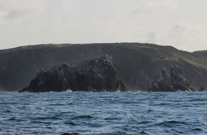
A colony of “Gannet” birds

Sailing along the Alderney coast

Water as flat as oil because of the current

The Swinge and the Island “Burhou”

Fort Clonque and the waves in the swinge behind it
Alderney is another lovely place to walk around. Around every corner there is another fort of some kind (counted 13 forts and a couple of batteries), most of which are from the Victorian age. Nazi/German occupation of the islands in 1940-1945 added some really ugly bunkers which for some unknown reason are still standing today. They also added bunkers to the old victorian forts. In addition, the occupiers had built at least three labour and one concentration camps. Ironically, they all got the rather nice sounding names of Lager Helgoland, Lager Norderney, Lager Borkum and Lager Sylt (the last one being the concentration camp). Forced labourers were obliged, among others, to keep reinforcing the defence works. In any event, the defense works had been so effective that when France was liberated the island stayed occupied for about another year!

Nazi/German air defense HQ

A new addition to the list of bunkers

Local “marina”

Miniature railway switch in a quarry

An “anchoring” bay on Alderney

The “Quesnard” lighthouse on Alderney
Most probably we are going to continue in the direction of the Netherlands tomorrow. We will no longer stop for extended periods of time unless the weather obliges us to do so. Hopefully we will be arriving in our home port of Enhkhuizen (Buyshaven) on the 12th of September in early afternoon. We will keep all of our loyal readers updated!
